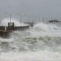
Hurricane Frances satellite animation available
Less than three weeks after being battered by Hurricane Charley, Floridians are bracing for Hurricane Frances, which struck the Bahamas today (Sept. 2) and is expected to hit Florida’s east coast by Saturday. Frances is a Category 4 storm, one step down from the most powerful hurricanes as measured by the five-level Saffir-Simpson Hurricane Scale. Category 4 storms, with winds between 131 and 155 mph, can cause tide surges of up to 18 feet and are capable of knocking down walls and blowing off roofs. Hundreds of thousands of people are preparing for the storm and possible evacuation.
To observe the storm and its track, scientists at UW–Madison’s Space Science and Engineering Center have developed a new satellite animation tool that provides detailed, near real-time movies of the hurricane as it approaches the Florida coast.
The animation shows the massive storm sweeping across the Bahamas toward Florida. Updated every half-hour, the movie is produced from visible and infrared satellite imagery obtained from the National Ocean and Atmospheric Administration’s GOES-12 satellite. Images of the storm are projected on a base map obtained from NASA’s Earth Observatory Team. This color, high-resolution base map shows the affected islands in detail.
According to staff scientist and hurricane expert Chris Velden, the new animation tool will be online throughout the hurricane season, enabling the public and scientists to track hurricanes and tropical storms in that storm-prone part of the world.

